|
|
Historical
Background
Unlike some of the other larger ethnic groups
of Southern Africa, the Venda constitutes a well defined
homogeneous entity. Before the arrival of the Whites,
the Venda led an isolated existence in the fertile Soutpansberg
area. They are linguistically related to the Shona tribes
of Zimbabwe Rhodesia and the Sotho of the Northern Transvaal.
The nation consists of a number of tribes, each under
the leadership of an independent tribal chief. The tribal
chiefs are related to one another and form a ruling
group that has governed for centuries. Incidentally,
some of the stone structures in Venda are reminiscent
of the Zimbabwe ruins on the Zimbabwe Rhodesian side
of the border.
The Venda people were to a large extent self-sufficient
in food production and also possessed their own iron
industry. Incentives for seeking con¬tact with neighbours,
who tended to be hostile, were lacking principally because
of the country's precipitous mountainous terrain.
The first white man in the area was Coenraad de Buys,
who arrived there around 1815 and established a settlement
today known as Mara. In 1836 he was followed by Louis
Trichardt, who later trekked to Delagoa Bay. In 1879
the Venda Chiefs first came into contact with a representative
of the British Administration when they met Sir Theophilus
Shepstone east of Elim.
The South African Republic established a frontier post
at Fort Hendrina in 1889. In 1902, after cessation of
hostilities between the Boers and the British, a police
camp was established at Tshanowa and taxation was then
introduced.
A census undertaken in 1904, which was probably not
done very thoroughly, revealed a population of 120,000
and in 1931 Stayt estimated the figure at 150000. The
1970 census indicated a population of 358 000 (46% male).
Political Development
The Venda nation comprises 27 tribes under
the authority of 27 chiefs, who also represent a number
of dynasties. These dynasties have traditionally cooperated
with one another and have helped to cement Venda unity.
Continued in next column
Source
Venda Brochure published by INTERSAPA (1979) |
|
The chief
of the Mphephu tribe is also the Chief Minister of
Venda.
Political development in modern times is characterized
by the principle of compromise between traditional
authority and Western-type democracy.
A territorial authority was instituted in 1962, and
more comprehensive executive powers were granted in
1969. Autonomous government was attained on 1 February
1973. This embodied a 6-member cabinet and a legislative
assembly consisting of 60 members, of whom 42 were
the traditional leaders and the remaining 18 elected
members who could be described as a blend between
the traditional and the modern.
The 1973 election aroused great enthusiasm and resulted
in a poll of 72% - a high percentage for a country
with no previous experience of Western election procedures.
Although the Venda Independence People’s Party
(VIPP) won the majority of elected seats it lacked
traditional support. In 1975 Chief Mphephu won a division
in a confidence debate by 34 votes to 19, the Chief
representing the hereditary rulers. In the 1978 election
the result was much closer under a new constitution
providing for 42 nominated and 42 elected members.
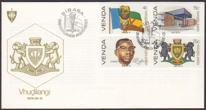
The new capital of Venda, Thohoyandou (head of the
elephant), is at present under construction.
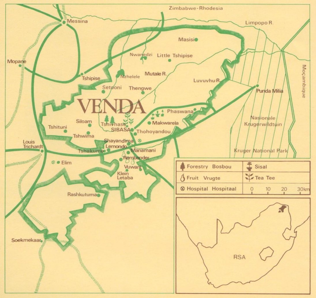
Geophysical Features
Venda consists of four geophysical units
between the latitudes 22° and 24°S and longitudes
29° and 32°E in the north of South Africa.
The boundaries are formed by the Limpopo River in
the north, with the Kruger National Park in the east,
the Levubu River and the Gazankulu self-governing
territory in the south-east, the Soutpansberg district
in the south-west, and the Messina district in the
north-west. Height above sea level varies from 200
to 1900m.
The total area of Venda is more than 630,000 ha at
present and the territory is divided into the four
districts of Sibasa, Dzanani, Vuwoni and Mutale.
Agriculturally Venda can be divided into three farming
regions, namely the cattle-grazing region north of
the Soutpansberg, the region on the South-western
plateau of the Soutpansberg range used mainly for
forestry, and the mixed farming region south of the
eastern foothills of the Soutpansberg.
Venda is practically frost-free and has a tropical
and sub-tropical climate. Rainfall varies between
350 mm in the Limpopo basin and 500 mm in the eastern
part, with a much higher fall in the mountains.
|
|


.jpg)
.jpg)
.jpg)
.jpg)
.jpg)
.jpg)
.jpg)


.jpg)

.jpg)
.jpg)
.jpg)
.jpg)
.jpg)
.jpg)
.jpg)
.jpg)
.jpg)
.jpg)
.jpg)
.jpg)
.jpg)
.jpg)
.jpg)
.jpg)
.jpg)
.jpg)
.jpg)
.jpg)
.jpg)
.jpg)
.jpg)
.jpg)
.jpg)
.jpg)
.jpg)
.jpg)
.jpg)
.jpg)
.jpg)
.jpg)
.jpg)
.jpg)
.jpg)
.jpg)
.jpg)
.jpg)
.jpg)
.jpg)
.jpg)
.jpg)
.jpg)
.jpg)
.jpg)
.jpg)
.jpg)
.jpg)
.jpg)
.jpg)
.jpg)
.jpg)
.jpg)
.jpg)
.jpg)
.jpg)
.jpg)
.jpg)
.jpg)
.jpg)
.jpg)
.jpg)
.jpg)
.jpg)
.jpg)
.jpg)
.jpg)
.jpg)
.jpg)
.jpg)
.jpg)
.jpg)
.jpg)
.jpg)
.jpg)
.jpg)
.jpg)
.jpg)
.jpg)
.jpg)
.jpg)
.jpg)
.jpg)
.jpg)
.jpg)
.jpg)
.jpg)
.jpg)
.jpg)
.jpg)
.jpg)
.jpg)
.jpg)
.jpg)
.jpg)
.jpg)
.jpg)
.jpg)
.jpg)
.jpg)
.jpg)
.jpg)
.jpg)
.jpg)
.jpg)
.jpg)
.jpg)
.jpg)
.jpg)
.jpg)
.jpg)
.jpg)
.jpg)
.jpg)
.jpg)
.jpg)
.jpg)
.jpg)
.jpg)
.jpg)
.jpg)
.jpg)
.jpg)
.jpg)
.jpg)
.jpg)
.jpg)
.jpg)
.jpg)
.jpg)
.jpg)
.jpg)
.jpg)
.jpg)
.jpg)
.jpg)
.jpg)
.jpg)
.jpg)
.jpg)
.jpg)
.jpg)
.jpg)
.jpg)
.jpg)
.jpg)
.jpg)
.jpg)
.jpg)
.jpg)
.jpg)
.jpg)
.jpg)
.jpg)
.jpg)
.jpg)
.jpg)
.jpg)
.jpg)
.jpg)
.jpg)
.jpg)
.jpg)
.jpg)
.jpg)
.jpg)
.jpg)
.jpg)
.jpg)
.jpg)
.jpg)
.jpg)
.jpg)
.jpg)
.jpg)
.jpg)
.jpg)
.jpg)
.jpg)
.jpg)
.jpg)
.jpg)
.jpg)
.jpg)
.jpg)
.jpg)
.jpg)
.jpg)
.jpg)
.jpg)
.jpg)
.jpg)
.jpg)
.jpg)
.jpg)
.jpg)
.jpg)
.jpg)
.jpg)
.jpg)
.jpg)
.jpg)
.jpg)
.jpg)
.jpg)
.jpg)
.jpg)
.jpg)
.jpg)
.jpg)
.jpg)
.jpg)
.jpg)
.jpg)
.jpg)
.jpg)
.jpg)
.jpg)
.jpg)
.jpg)
.jpg)
.jpg)
.jpg)
.jpg)
.jpg)
.jpg)
.jpg)
.jpg)
.jpg)
.jpg)
.jpg)
.jpg)
.jpg)
.jpg)
.jpg)
.jpg)
.jpg)
.jpg)
.jpg)
.jpg)
.jpg)
.jpg)
.jpg)
.jpg)
.jpg)
.jpg)
.jpg)
.jpg)
.jpg)
.jpg)
.jpg)
.jpg)
.jpg)
.jpg)
.jpg)
.jpg)
.jpg)
.jpg)
.jpg)
.jpg)
.jpg)
.jpg)
.jpg)
.jpg)
.jpg)
.jpg)
.jpg)
.jpg)
.jpg)
.jpg)